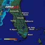
A squall line of thunderstorms will move through Orange County very late this evening and throughout the overnight hours into Thursday morning. This front carries the potential of severe storms and isolated tornadoes.
 The line of storms is expected to move into western Orange County between 10:00 pm and 12:00 midnight then move southeastward through the county overnight, clearing the county by 6:00 am. Individual storm cells along this line will be moving toward the northeast. The potential is for high wind gusts, maybe 50 to 60 mph, along with periods of heavy rainfall. There is a potential for storm cell rotation leading to isolated tornadoes although the greatest threat for tornadic activity will be to our north.
Due to the changing nature of weather conditions, the Orange County Office of Emergency Management suggests that you pay particular attention to weather broadcasts today, especially this evening before going to bed, for the latest weather conditions and forecast. If you have a NOAA Weather Radio, make sure it is turned on and set to the correct channel for good reception. Continue to monitor Television and Radio weather broadcasts and NOAA Weather Radio.
Source: OCALERT


