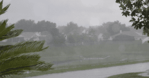
Tropical Storm Debby, currently dumping rain across Central Florida, at 4:00 p.m., on Sunday was moving toward the northeast, the National Hurricane Center said.

According to NHC:
The Center of Debby was located near latitude 28.4 north, longitude 85.8 west. Debby is moving toward the northeast near 3 mph and no significant motion is expected during the couple of days, but this forecast continues to be uncertain.
Maximum sustained winds are near 60 mph with higher gusts. Some slight strengthening is pussible during hte next 48 hours. Tropical storm force winds extend outward up to 200 miles ffrom the center.
Tropical storm conditions are already near or over portions of the northeast Gulf Coast and are expected to reach the remainder of the warning area by tonight.
Debby is expected to produce total rain accumulations of 5-10 inches over much of the Florida panhandel, northern Florida, Central Florida and Southeastern Georgia with isolated maximum amounts of 15-20 inches possible.
The combination of a storm surge and the tide will cause normally dry areas near the coast to be flooded by rising waters. The water could reach the following depths above ground at the times of high tide over the next few days:
Apalachee Bay————–4 to 6 feet
Florida West Coast South of Apalachee Bay———2 to 4 feet
Coastal Mississippi Eastward to Apalachee Bay——2 to 4 feet
Southeastern Louisiana———-1 to 3 feet.
Meanwhile, there are reports of flooding and downed wires due to fallen trees and tree branches in Hillsborough County. Also, there have been reports of street flooding including eastbound and westbound lanes on West Hillsborough Ave and West Waters Ave between Hanley Rd and Sawyer Rd are reportedly completely under water.
In West Pasco County a number of streets are impassable and major intersections are becoming overwhelmed with water, causing vehicles to become stranded. Areas west of the U.S. 19 corridor are especially vulnerable.
In Tampa, BayShore Boulevard is blocked off from S. Rome Avenue to W. Swann Avenue due to flooding.
The State Emergency Operations Center is currently operating at a Level Two – partial activation – to support the needs of the impacted counties, according to Florida Division of Emergency Management.
The Atlantic Hurricane Season runs from June 1 – November 30. To GET A PLAN! visit www.FloridaDisaster.org. For the latest information on the 2012 Hurricane Season, follow us on Twitter at www.Twitter.com/flsert and on Facebook at www.Facebook.com/FloridaSERT.


